


By Dan Mathers
There are levels to hiking.
Climbing a mountain peak is a great way to spend a day. But attempting a mountain traverse requires something more than a few hours and enthusiasm. It requires another level of planning, fitness, and mental fortitude.
If you’re ready to move up from bagging single peaks to tackling a full traverse, then this list is for you.
Hikers from other parts of the country might look at the modest elevation of Northeast mountain ranges and think a traverse here is easy.
Those hikers would be wrong.
What our mountain ranges might lack in elevation, they more than make up for in ruggedness. Exposed summits, steep rock scrambles, granite ridges, dense forests, unpredictable weather, and twisting trails packed with ankle-breaking rocks and roots combine to create some intense and challenging mountain journeys.
What constitutes a proper mountain traverse might be open to opinion. Some purists will say at least one “traverse” we chose for this list isn’t a traverse at all. Others will get red-faced and yell “How can you leave off Knife Edge and Franconia Ridge?!?!” (Knife Edge, while the Northeast’s most dramatic ridge, isn’t long enough to meet our critieria. Franconia Ridge is part of a larger entry we included.)
Some of these traverses can be completed in a single long day, while others are best done as multi-day adventures. Of course, how long a traverse takes you depends a lot on your fitness and experience.
Here are nine of the best mountain traverses in the Northeast.

Presidential Traverse
New Hampshire
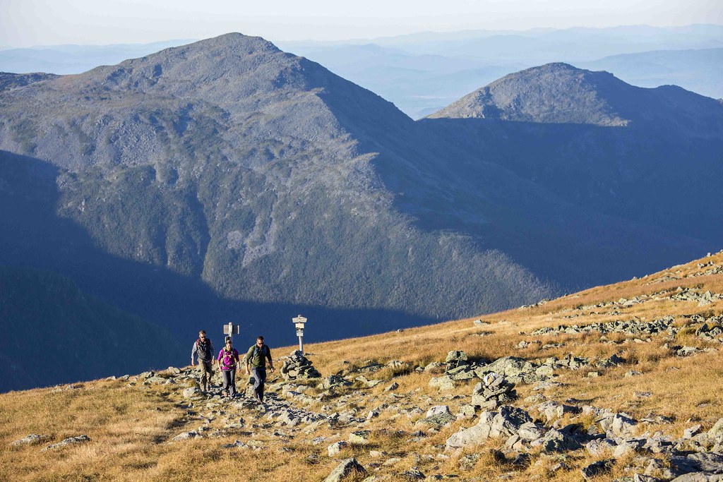
New Hampshire’s Presidential Traverse is hands-down the most iconic mountain traverse in the Northeast. It crosses the spine of the Presidential Range, linking a succession of summits that include Mount Madison, Mount Adams, Mount Jefferson, Mount Washington, Mount Monroe, Mount Eisenhower, and Mount Pierce. That’s seven of New Hampshire’s 4,000-footers, including five of the Granite State’s tallest mountains. Much of the route is above treeline, which provides hikers with incredible views in good weather, but can also leave hikers dangerously exposed in bad weather.
At around 19 miles long, the Fastest Known Time website describes the route as one of the most rugged sub-20-mile routes in existence. But depending on the route hikers take and which additional peaks are included, the traverse can be closer to 23 miles with roughly 9,000 feet of elevation gain.

Mahoosuc Range Traverse
Maine & New Hampshire
If there’s one word that repeatedly comes up when hikers describe the Mahoosuc Traverse, it is “rugged.”
The traverse follows the Appalachian Trail along the Mahoosuc Range from Grafton Notch in Maine to the White Mountains in New Hampshire. It’s more than 28 miles long with over 10,000 feet of elevation gain. The traverse passes through some of the harshest terrain in the Northeast. It’s been described as the region’s hardest 50K, and it is home to what is widely considered the hardest single mile on the entire Appalachian Trail: Mahoosuc Notch. The Notch is home to enormous boulders that force hikers to scramble, climb, duck, and sometimes squeeze their way through gaps.
The Mahoosuc Traverse doesn’t treat hikers to long stretches of open ridgeline like those found along the Presidential Traverse. Instead, the traverse features constant climbs over rocky summits followed by steep descents into dense forest.
The traverse is a tough one, even for highly experienced hikers, as the challenging terrain makes the mileage feel much longer than it is. Hikers should carefully plan out water and overnight camping locations, and keep a close eye on the weather. But as tough as the traverse is, the views from such peaks as Old Speck and Mount Carlo, and the feeling of accomplishment when you’ve completed it, make the challenge well worth it.

Great Range Traverse
Adirondack High Peaks, New York
The Great Range Traverse in the Adirondack High Peaks is one of the great mountain challenges in the entire Northeast. The traverse is extremely challenging, and is kind of a combination of aspects of both the Presidential and Mahoosuc Traverses: offering incredible views and summiting some of the Adirondacks’ highest peaks, while also hitting hikers with a brutal succession of ups-and-downs and highly technical terrain.
While there is no one universally-accepted route for the traverse, it is generally considered a little over 20 miles with more than 9,000 feet of elevation gain. It includes some of the Adirondacks’ most famous peaks—Lower Wolfjaw, Upper Wolfjaw, Armstrong, Gothics, Saddleback, Basin, and Haystack—with New York’s highest peak, Mount Marcy, often added, even though it is not technically part of the Great Range.
The traverse requires a lot of technical hiking where hikers use their hands almost as much as their feet. It features steep rock faces, scrambles, and even ladders.
Bigelow Range Traverse
Maine
This traverse in western Maine has been described as one of the country’s hardest day hikes. Bigelow Range rises above Flagstaff Lake and features several significant summits, including West Peak and Avery Peak, which are both over 4,000 feet.
The traverse is roughly 16.5 miles with just under 7,000 feet of elevation gain. It features challenging climbs and descents, dense woods, and open ridge. It feels extremely remote, surrounded by vast stretches of wilderness. On clear days, though, the ridge provides stunning views of the surrounding area and Flagstaff Lake below.

Pemigewasset Loop
New Hampshire
Yes, I know. The Pemigewasset Loop is not technically a traverse. It’s a loop. I get it. But the idea of leaving one of the Northeast’s most iconic mountain adventures off this list because of a technicality just feels … gross.
The route circles the heart of New Hampshire’s Pemigewasset Wilderness, linking a series of high peaks and two incredible stretches of exposed ridgeline: Franconia Ridge and the Bonds. While hikers can choose from many variations, the classic route is roughly 30 miles and more than 9,000 feet of elevation gain. It hits eight 4,000-footers, and with a few short detours along the way, hikers can hit up to 12 4,000-footers.
The Pemi is rocky and challenging, with steep ascents and descents. Most hikers split it into two or three days, turning the trip into a wilderness backpacking experience.
After climbing out of the forest, the route traverses Franconia Ridge, one of the most stunning stretches of ridgeline in the entire Northeast. Following Franconia Ridge, the route goes through a long stretch of rugged wilderness before climbing again into the Bonds, where Bondcliff provides one of the most iconic views in all of the White Mountains.

Devil’s Path
New York
This aptly-named trail in the Catskills is widely considered to be the toughest hiking trail in the Eastern United States. Hikers like to debate such titles, but one thing is certain: after doing this route, your legs will certainly consider it evil.
The Devil’s Path is sneaky tough. Its highest point is under 4,000 feet, so how hard can it be? Really hard, actually. The route crosses the Catskill Escarpment. Along the way, it passes over five of the Catskills’ highest peaks while also repeatedly plunging into deep notches. The result is about 24 miles with roughly 9,000 feet of elevation gain along terrain that is the stuff of horror movies.
The route might be the Northeast’s best example that low mountains can still provide very big, difficult challenges. While some highly experienced hikers and ultrarunners might do the trail in a day, most tackle it over several days. If you do, make sure to carefully plan your water and any resupply.

Kinsman Range Traverse
New Hampshire
This traverse along the Kinsman Ridge Trail follows the spine of the Kinsman Range between Kinsman Notch and Franconia Notch, crossing North and South Kinsman and eventually connecting with Cannon Mountain. The route is about 16 miles with roughly 6,000 feet of elevation gain.
This route features fewer extended stretches above treeline and more time in deep forest. But occasional openings along the rocky ridges provide views across the White Mountains. South Kinsman features an excellent mountain summit, with ledges and views of Franconia Notch.
Dix Range Traverse
New York
One of the more under-the-radar Northeast traverses, the Dix Range Traverse provides hikers with sustained views across the entire mountain journey. The traverse is a little over 15 miles with more than 5,000 feet of elevation gain. It contains five Adirondack High Peaks: Macomb, South Dix, East Dix, Hough and Dix Mountain.
The famous slide on Macomb is one of the highlights of the route. It’s also why the direction a hiker chooses matters. Hikers may prefer to climb the slide early in the journey rather than descend the steep slide after a long day of hiking.
Navigation is important on this traverse. Some of the route uses unofficial herd paths rather than well-maintained trails. The terrain can also be rough and steep. So, despite the somewhat modest length and elevation of this traverse, it is not one to be undertaken casually.

Monroe Skyline Traverse
Vermont
Vermont’s most iconic ridge traverse is the Monroe Skyline. The route follows a section of the Long Trail between Lincoln Gap and Appalachian Gap.
The Monroe Skyline traverse is just over 10 miles long and features a little under 3,000 feet of elevation gain. The prominent ridgeline features several peaks, including two of Vermont’s 4,000-foot peaks: Mount Abraham and Mount Ellen.
With long stretches on the ridge, the route is one of the most beautiful sections of the Long Trail.